
Dashpivot article – AS5488 quality levels

AS5488 Quality Levels
What is AS5488?
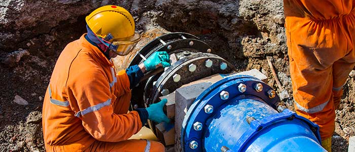
AS5488 is a standard in Australia used for locating and identifying subterranean utilities. It provides guidelines for the accurate localisation and identification of subsurface facilities to prevent damage to telecommunications, electricity, gas, water, and sewage services during excavation and construction.
The goal of the guidelines is to upgrade worker and public safety while minimising the problematic repairs and service interruptions. The AS5488 has many topics discussed. A few examples are utility location markings, the use of locating equipment, and the recording and reporting of utility information.
Implementing AS5488 calls for a combined effort across several disciplines. Some of the workers on and around buried services lack all the necessary abilities to acquire all the required knowledge. The standard affects asset owners, installation teams, the building sector overall, locaters, surveyors, engineers, and project managers, all of whom must cooperate to make it function.
One can devise efficient strategies to "harvest" this crucial knowledge and forward it to the persons most in need. Every service we employ in the twenty-first century is becoming ever more crucial. Gathering this knowledge and maintaining this crucial infrastructure safe helps everyone everywhere.
What are the AS5488 quality levels?
Quality Level A
This is the only quality level that really validates the subterrean utility. Quality A has absolute spatial positioning with strict vertical and horizontal tolerances of ± 50 mm in locating the points surveyed on the surface and subsurface. Quality Level A requires and presents extensive detail on the utility type. The utility type is exhibited by the following information: type, status, material, size, and configuration. Other information found on Quality A that made it the most robust level are utility owner, date of installation, and feature codes of surface and subsurface features (not limited to pits, access chambers, poles, and valves).
Quality Level A, acronymed as QL-A, presents the following metadata: the date that the data was captured, the source of information, the survey, and locating methods used to determine the absolute spatial position of utility.
Quality Level B
Relative subsurface feature location in three dimensions is provided in Quality Level B. Relative position is the distance or depth from another landmark, say a firehydrant pipe, 7 feet below surface level and 4 feet from the edge of a sidewalk. QL-B data calls for specialist tools and locaters adept in tracking utilities (detection via an induced signal along a subsurface utility). For QL-B, relative spatial positioning is ± 300 mm horizontal and ±500 mm vertical.
Quality Level B, acronymed as QL-B, presents the following metadata: the date the data was captured, the source of information, and the locating method(s) used to obtain the attribute information.
Quality Level D
Should any of the other quality levels prove unsatisfactory, Quality Level D is the lowest quality level and default level. Existing records, casual site visits, or anecdotal evidence could all help to gather this material. Only a broad indication of position is needed; no spatial tolerance is required.
Quality Level D, acronymed as QL-D, presents the following metadata: the date and data captured, and the source of the information.
Quality Level C
makes advantage of any accessible QL-D data and links it with surface features. These elements could be surface access points for hydrants, stop valves, access chamber lids, or points of utility entry into the subsurface domain—that is, an electric line descended from a power pole.
Unlike QL-D, which simply suggests a rough indication of location, subsurface utilities may be offset from the alignment of surface features, hence QL-C does not offer a spatial tolerance on location.
Quality Level B, acronymed as QL-C, presents the following metadata: the date and data captured, and the source of the information.
Smart Documentation of the AS5488 Quality Levels in your Report
Part of compliance around AS5488 quality levels involves documenting the quality levels when conducting field reports.
If you are still running these reports with paper, then you are risking non compliance in some Geotechnical and safety processes, as well as creating unnecessary admin and work for your team.
You can try streamlining your reports and AS5488 quality level documentation with Dashpivot. With Dashpivot, you can use a digital utility service locating form to help your team capture detailed reports on site directly from their mobile or tablet.

Dashpivot also offers a form that comes standardised with all of the sections and fields you need to capture, what the utility is, the category, the quality level of the accuracy for the information, where it is, what was used to capture the information, and more.
Utility locating form
Complete and organise your daily diaries more efficiently.
Snag list
Complete and organise your daily diaries more efficiently.
Witness point
Complete and organise your daily diaries more efficiently.
Sitemate builds best in class tools for built world companies.
